


Litchfield County PUMA, Connecticut
About
Outline

Summary
| Unique Area Identifier | 192513 |
| Name | Litchfield County PUMA |
| State | Connecticut |
| Area (square miles) | 944.56 |
| Land Area (square miles) | 920.56 |
| Water Area (square miles) | 24.00 |
| % of Land Area | 97.46 |
| % of Water Area | 2.54 |
| Latitude of the Internal Point | 41.79189670 |
| Longtitude of the Internal Point | -73.23542790 |
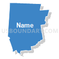
Maps

Graphs
Select a template below for downloading or customizing gragh for Litchfield County PUMA, Connecticut


Neighbors
Neighoring Public Use Microdata Area (by Name) Neighboring Public Use Microdata Area on the Map
- Berkshire County--Pittsfield City PUMA, MA
- Bristol, Southington & Burlington Towns PUMA, CT
- Danbury, Ridgefield, Bethel, Brookfield, New Fairfield, Redding & Sherman Towns PUMA, CT
- Dutchess County (North & East) PUMA, NY
- Hampden (West & East) & Hampshire (South) Counties--Northampton City PUMA, MA
- Hartford County (North) PUMA, CT
- New Haven County (Northwest) PUMA, CT
- Stratford, Shelton, Trumbull, Newtown & Monroe Towns PUMA, CT
- Waterbury Town PUMA, CT
- West Hartford, Farmington, Simsbury, Bloomfield, Avon & Canton Towns PUMA, CT
Top 10 Neighboring County (by Population) Neighboring County on the Map
- Fairfield County, CT (916,829)
- Hartford County, CT (894,014)
- New Haven County, CT (862,477)
- Hampden County, MA (463,490)
- Dutchess County, NY (297,488)
- Litchfield County, CT (189,927)
- Berkshire County, MA (131,219)
Top 10 Neighboring County Subdivision (by Population) Neighboring County Subdivision on the Map
- Waterbury town, New Haven County, CT (110,366)
- Bristol town, Hartford County, CT (60,477)
- Torrington town, Litchfield County, CT (36,383)
- New Milford town, Litchfield County, CT (28,142)
- Newtown town, Fairfield County, CT (27,560)
- Watertown town, Litchfield County, CT (22,514)
- Southbury town, New Haven County, CT (19,904)
- Wolcott town, New Haven County, CT (16,680)
- Brookfield town, Fairfield County, CT (16,452)
- New Fairfield town, Fairfield County, CT (13,881)
Top 10 Neighboring Place (by Population) Neighboring Place on the Map
- Waterbury city, CT (110,366)
- Bristol city, CT (60,477)
- Torrington city, CT (36,383)
- Oakville CDP, CT (9,047)
- Winsted CDP, CT (7,712)
- New Milford CDP, CT (6,523)
- Terryville CDP, CT (5,387)
- Collinsville CDP, CT (3,746)
- Watertown CDP, CT (3,574)
- Northwest Harwinton CDP, CT (3,252)
Top 10 Neighboring Elementary School District (by Population) Neighboring Elementary School District on the Map
- New Hartford School District, CT (6,970)
- Barkhamsted School District, CT (3,799)
- Salisbury School District, CT (3,741)
- Sherman School District, CT (3,581)
- North Canaan School District, CT (3,315)
- Kent School District, CT (2,979)
- Sharon School District, CT (2,782)
- Farmington River Regional School District, MA (2,527)
- Hartland School District, CT (2,114)
- Norfolk School District, CT (1,709)
Top 10 Neighboring Secondary School District (by Population) Neighboring Secondary School District on the Map
- Regional High School District 01, CT (15,471)
- Regional High School District 07, CT (13,963)
- Lee/Berkshire Hills in Farmington River Regional (7-12), MA (2,527)
Top 10 Neighboring Unified School District (by Population) Neighboring Unified School District on the Map
- Waterbury School District, CT (110,366)
- Bristol School District, CT (60,477)
- Torrington School District, CT (36,383)
- New Milford School District, CT (28,142)
- Newtown School District, CT (27,560)
- Regional School District 15, CT (27,479)
- Watertown School District, CT (22,514)
- Wolcott School District, CT (16,680)
- Brookfield School District, CT (16,452)
- Regional School District 10, CT (14,943)
Top 10 Neighboring State Legislative District Lower Chamber (by Population) Neighboring State Legislative District Lower Chamber on the Map
- Assembly District 103, NY (134,686)
- Fourth Berkshire District, MA (37,775)
- State House District 17, CT (25,082)
- State House District 71, CT (24,975)
- State House District 76, CT (24,317)
- State House District 80, CT (24,200)
- State House District 78, CT (24,163)
- State House District 106, CT (24,049)
- State House District 79, CT (23,980)
- State House District 62, CT (23,806)
Top 10 Neighboring State Legislative District Upper Chamber (by Population) Neighboring State Legislative District Upper Chamber on the Map
- State Senate District 40, NY (316,324)
- Second Hampden & Hampshire District, MA (156,603)
- Berkshire, Hampshire & Franklin District, MA (149,418)
- State Senate District 16, CT (105,218)
- State Senate District 24, CT (104,062)
- State Senate District 28, CT (103,194)
- State Senate District 30, CT (102,325)
- State Senate District 32, CT (101,305)
- State Senate District 5, CT (98,818)
- State Senate District 8, CT (98,790)
Top 10 Neighboring 111th Congressional District (by Population) Neighboring 111th Congressional District on the Map
- Congressional District 5, CT (714,296)
- Congressional District 1, CT (710,951)
- Congressional District 19, NY (699,959)
- Congressional District 20, NY (683,198)
- Congressional District 1, MA (644,956)
Top 10 Neighboring Census Tract (by Population) Neighboring Census Tract on the Map
- Census Tract 3602, Litchfield County, CT (7,765)
- Census Tract 4681.01, Hartford County, CT (7,468)
- Census Tract 2532, Litchfield County, CT (7,429)
- Census Tract 4058, Hartford County, CT (7,388)
- Census Tract 8130, Hampden County, MA (7,234)
- Census Tract 4056, Hartford County, CT (7,222)
- Census Tract 2301, Fairfield County, CT (7,061)
- Census Tract 2052, Fairfield County, CT (7,054)
- Census Tract 3061, Litchfield County, CT (6,970)
- Census Tract 3201, Litchfield County, CT (6,345)
Top 10 Neighboring 5-Digit ZIP Code Tabulation Area (by Population) Neighboring 5-Digit ZIP Code Tabulation Area on the Map
- 06010, CT (60,448)
- 06790, CT (36,482)
- 06708, CT (29,418)
- 06776, CT (26,889)
- 06704, CT (25,139)
- 06488, CT (19,904)
- 06716, CT (16,680)
- 06804, CT (16,466)
- 06470, CT (16,003)
- 06795, CT (14,144)